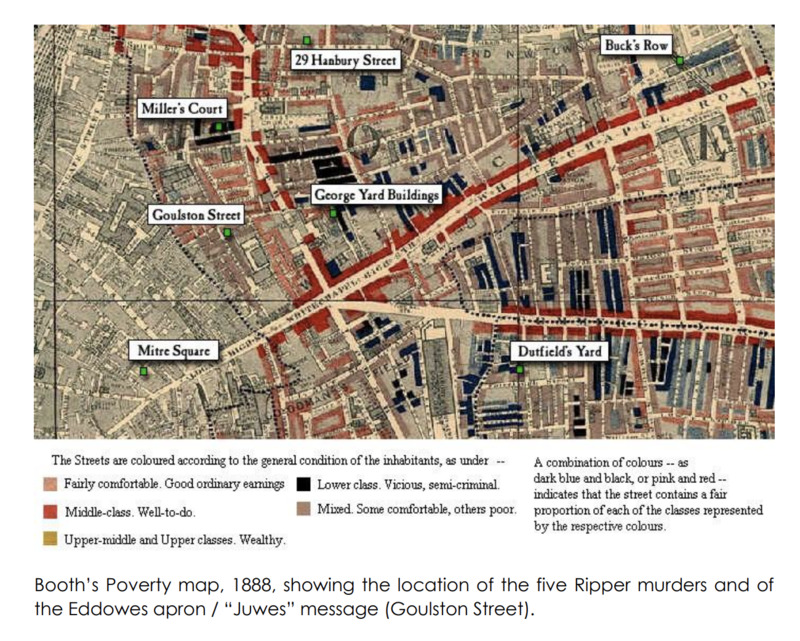
Edited Copy of the Whitechapel section of Charles Booth's London Poverty Map
Item
-
Title
-
Edited Copy of the Whitechapel section of Charles Booth's London Poverty Map
-
Alternative Title
-
Booth's Poverty Map, 1888, showing the location of the five Ripper murders and of the Eddowes apron
-
Description
-
A cropped part of Charles Booth's 1888 Poverty Map featuring the Whitechapel district of London and marked with locations where Ripper victims were murdered or case evidence was discovered.
-
Contributor
-
Cranbourne School
-
Creator
-
Charles Booth
-
Date
-
1888
-
Extent
-
1 map
-
Format
-
Image
-
Is Part Of
-
"Labour and Life of the People, Volume 1: East London"
-
Language
-
English
-
Provenance
-
The Cranbourne School, sourced from the Museum of London
-
Publisher
-
Macmillan (London)
-
Rights
-
Public domain
-
Subject
-
Social mapping of poverty in late nineteenth-century London, England
-
Temporal Coverage
-
1888-1889
-
Type
-
Map
 whitechapel_pov_map.jpg