Treaties Between the United States Government and Tribal Nations
Treaties:
Here are a series of treaties between the United States and tribal governments residing in what is now Michigan. Beginning with the Treaty of Detroit, these documents depict the gradual annexation of indigenous land into colonial control and the subsequent formation of Michigan's statelines.
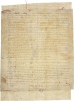
Treaty of Detroit (1)
Signed September 24, 1819, between the United States and the Ottawa, Chippewa, Wyandot and Potawatomi tribes. The tribes ceded eight million acres of land which encompassed southeast Michigan and northwest Ohio north of the Maumee River.
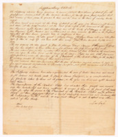
Treaty of Saginaw
Signed September 24, 1819, between the United States and the Chippewa, Ottawa, and Potawatomi tribes. The tribes ceded six million acres of land which encompassed much of the central and eastern lower peninsula of Michigan.
Treaty of Chicago
Signed August 29, 1821, between the United States the Chippewa, Ottawa, and Potawatomi tribes. The tribes ceded almost four million acres of land which encompassed all lands in Michigan south of the grand river and land in Indiana and Illinois on the southern coast of lake Michigan.

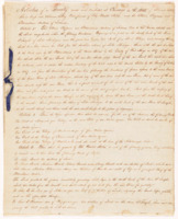
Treaty of Washington D.C.
Signed March 28, 1836, between the United States and the Ottawa and Chippewa tribes. The tribes ceded almost fourteen million acres of land which encompassed the northwestern lower peninsula and eastern part of the upper peninsulas in Michigan.

Treaty of La Pointe
Signed October 4, 1842, between the United States and the Chippewa nation. The Chippewa's ceded an extensive amount of land which encompassed the western part of Michigan’s upper peninsula and parts of northern Wisconsin.
Maps:
These historic maps visually represent the changing jurisdictions outlined in the treaties above.
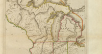
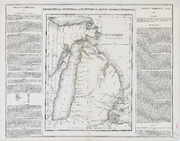
The Upper Territories of the United States, 1814
1814 map of Michigan showing the boundries made from the Treaty of Detorit. Located in southeast Michigan.
Michigan Territory, 1822
1822 map of Michigan showing the boundries made from both the Treaty of Saginaw and the the Treaty of Chicago. Located in Southeast Michigan. The new boudnries drawn are located in mid-Michigan.
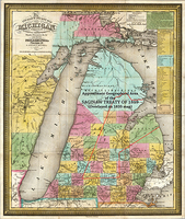
Michigan, 1835
1835 map of Michigan with the treaty of Saginaw overlayed on the map in a red outline.
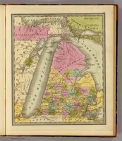
Michigan, 1840
1840 map of Michigan showing the boundries made from the Treaty of Washington D.C. colored in pink. Located in the north and northwest.
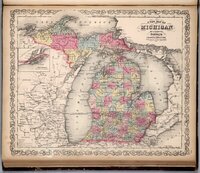
Michigan, 1859
1859 map of Michigan showing the modern boundries of Michigan made from the Treaty of La Pointe. Located in the west upper peninsula of Michigan.