Michigan, 1859
Item
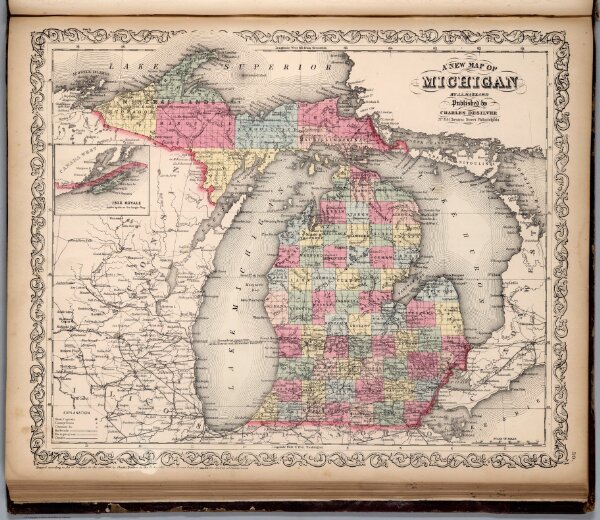
- Title
- Michigan, 1859
- Rights
- David Rumsey Historical Map Collection
- Type
- Atlas Map
- Creator
- Samuel Augustus Mitchell
- Date
- 1859
- Description
- A 1859 map of Michigan that shows the established boarders for Michigan that stay relatively the same up to the present time.
- Language
- English
- Publisher
- Charles Desilver
- Subject
- Map
- Item sets
- Treaties and Maps of Michigan
- Media
 Michigan, 1859